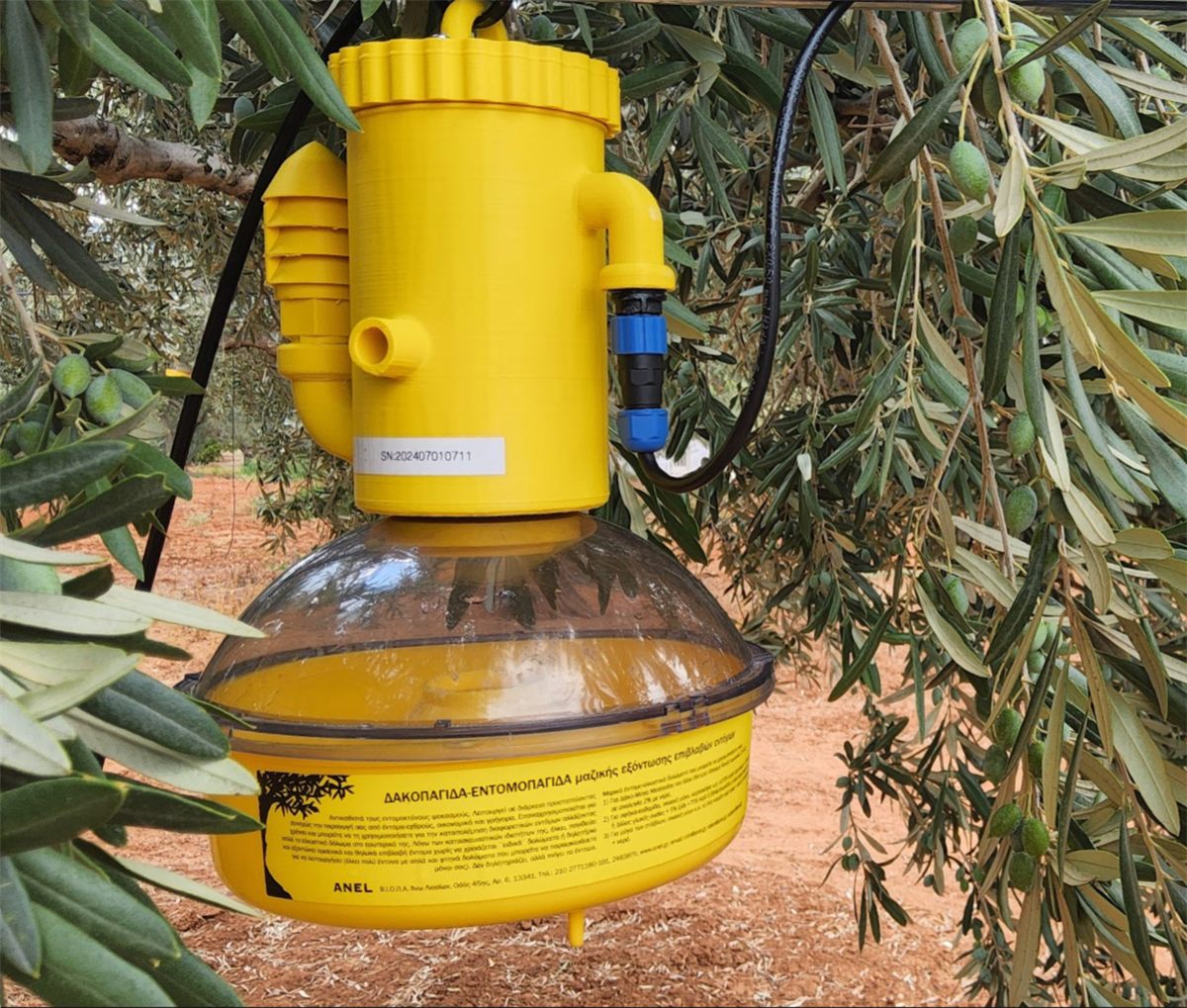
AgroNIT electronic trap in an olive grove
earth.pan-gaea.gr · Smart Farming

Leading the Transition to Sustainable Agriculture.

Using the Agro-Nit platform and the wizCube ecosystem, we provide precision irrigation and crop management based on real-time field needs.

Smart Farming

Agriculture provided the foundation of civilisation 12,000 BC

Today, the salvation of civilisation requires radical innovation towards a sustainable agriculture. With the world's population expected to reach 9.7 billion by 2050, agriculture must become more productive and more sustainable.

12,000 BCAgriculture lays the foundation of civilisation
7.7 bnPeople today, up from 1 billion two centuries ago
9.7 bnExpected world population by 2050

Adopting new technologies can transform the global food production system and reduce its impact on the climate and the environment. Digital agriculture systems can also reduce food waste at every stage of the supply chain.

Modern agriculture is on the verge of a digital renaissance. Cutting-edge technologies and information systems allow more efficient management of natural resources while limiting environmental impacts. Through smart agriculture, producers can identify the true needs of crops in real time.

Modern precision farming systems rely on new technologies working with information systems for:

  • recognising spatial and temporal variation;
  • identifying the real needs of a crop;
  • technological systems for controlling crop inputs;
  • collecting, processing and transmitting large volumes of data anywhere, anytime, in real time.
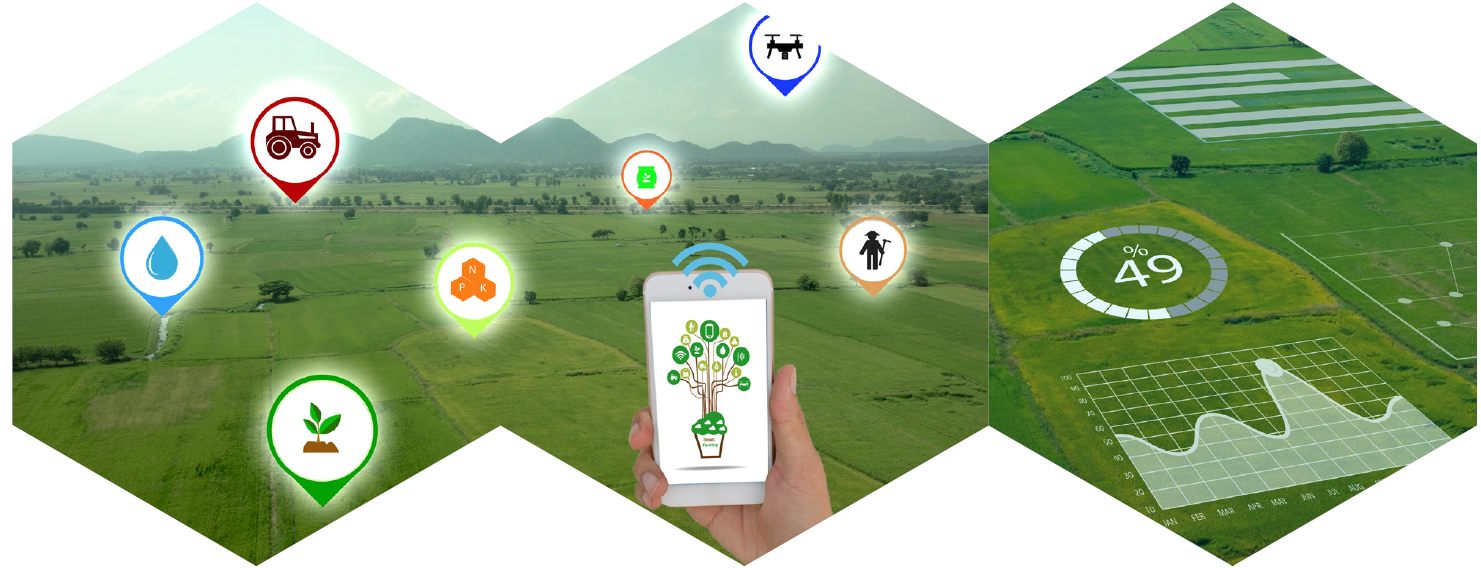
Smart farming icons over a young crop field
Article: “The Necessity of Adopting New Technologies in Modern Agriculture” — Prof. Athanasios Korakis

Modern agriculture faces many challenges related to the economy and crop productivity. Conventional production methods do not seem able to cope with these challenges, often making agriculture unsustainable. One response is to modernise agriculture by adopting technological solutions developed within the framework of Precision Agriculture.

Precision Agriculture is a method of field management in which inputs (pesticides, fertilisers, seeds, irrigation water) and cultivation practices are applied according to the needs of crops and soil, as these vary across space and time with changing environmental conditions.

Precision agriculture systems first identify the current condition of a crop or field. The collected data are then analysed and interpreted to identify management zones with common soil and agronomic features. Management zones enable variable-rate application of inputs, so that the actual needs of each area are met: saving resources, protecting the environment, and increasing yield and quality.

Key enabling technologies include:

  • Distributed collection of field and environmental information: IoT, distributed sensor infrastructures, multi-/hyperspectral cameras (static or on UAVs), satellite imagery.
  • Real-time information transfer: wireless sensor networks.
  • Real-time data collection, storage and analysis: cloud computing.
  • Information processing and extraction of conclusions: Big Data analysis and data mining.
  • Real-time farmer notification and application of control rules in the field: web or smartphone applications and automated control in distributed nodes.

Despite the obvious benefits, Greece and Southern Europe are slow to adopt such systems, mainly because of (a) the lack of readily applicable technologies for a wide range of crops, (b) the high commercial cost of available systems, and (c) the complexity of installation, application and maintenance.

Universities and research institutes, working with private-sector bodies and producer groups (cooperatives), can play a key role in creating practical solutions that Greek farmers can apply immediately. The Telecommunications and Networks Laboratory (NITLab) of the University of Thessaly develops innovative IoT solutions with tangible applications in precision agriculture, with emphasis on 5G, cloud computing, wireless and sensor networks and internet applications.

The core system consists of spatially distributed, energy-autonomous nodes with integrated sensors for temperature, soil moisture, atmospheric pressure, solar energy and more. Data are transmitted wirelessly to gateways, forwarded to the cloud, and analysed by software with integrated Big Data and data-mining tools. Decisions are communicated to farmers through web applications and can also activate control mechanisms in the field, such as solenoid valves for irrigating specific areas.

Initial results from the laboratory's pilots are encouraging: precision agriculture in Greece can be highly effective, but it requires a change of mindset, cooperation among stakeholders and the gradual use of existing expertise to develop low-cost, high-accuracy tools tailored to each field and crop.

Prof. Athanasios Korakis, Director, Telecommunications & Networks Laboratory (NITLab), University of Thessaly
Platform

AGRO-NIT: Integrated digital platform for smart agriculture

AgroNIT services bring the most modern communication technologies into primary agricultural production. They identify the real needs of a crop under the conditions in its environment, so that the most appropriate cultivation practices can be applied at plant level. The result is savings and efficient use of resources, lower production costs, fewer environmental side effects, higher yields and better product quality.

Precision agriculture services

We provide precision agriculture services using cutting-edge methods and technology: satellites, UAVs/drones, the Internet of Things, weather forecasting and modification.

  • Satellite imagery
  • UAVs / Drones
  • IoT sensor networks
  • Weather forecasting
  • Variable-rate inputs
  • Decision support

The AgroNIT app

Available on Android & iOS and on the web. Try the demo account:

Usernamedemo_account
Passworddemo1234
QR codes to download the AgroNIT app for Android and iOS
Scan to download the AgroNIT app
Innovating precision agriculture

AgroNIT: a smart-farming IoT ecosystem

AgroNIT logo

Smart farming starts by identifying the current state of a crop or field through distributed, real-time collection of field and crop data. Analysing and interpreting these data points to the best cultivation practice for each field, including variable-rate application of water, nutrients and other inputs to meet the real, site-specific needs of the crop. The result is more efficient use of resources, lower costs, better protection of the environment, and higher yields and quality.

AgroNIT ecosystem: sensors, drones and the mobile app across the field

AgroNIT was developed with NITLab (University of Thessaly), which has built integrated precision-agriculture solutions based on wireless sensor networks, cloud technologies, farm management software and decision support tools.

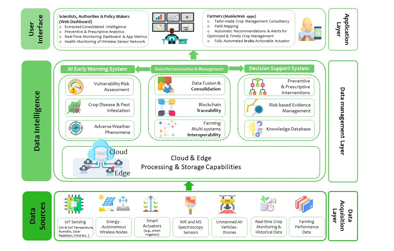
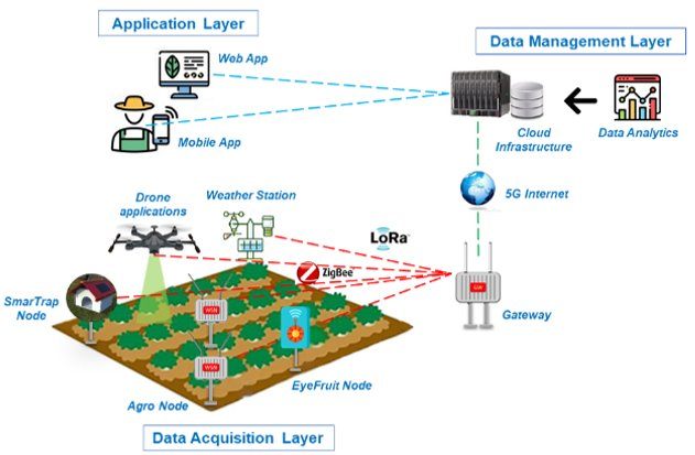
Three-layer architecture

Data acquisitionWireless sensor networks in the field: agro nodes, weather stations, camera nodes and gateways.
Data managementCloud and edge infrastructure for storage, processing, data fusion and traceability.
ApplicationThe AgroNIT web and mobile app for farmers, agronomists and policy makers.
AgroNIT architecture: data sources, data intelligence with AI early warning and decision support, and user interfaces
From data sources to AI early warning, decision support and the user interface

The wireless sensor network

Agro node

Air temperature/humidity, soil temperature, soil water potential and leaf wetness, at crop level.

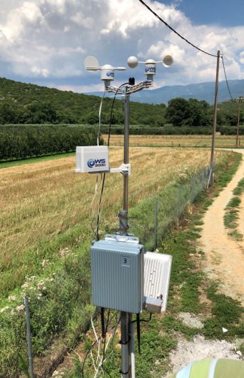
Weather station

Wind speed and direction, precipitation and solar radiation, at the edge of the field.

EyeFruit node

A camera on the tree photographs fruit several times a day; AI estimates size, colour and ripening for optimised harvesting.

SmarTrap node

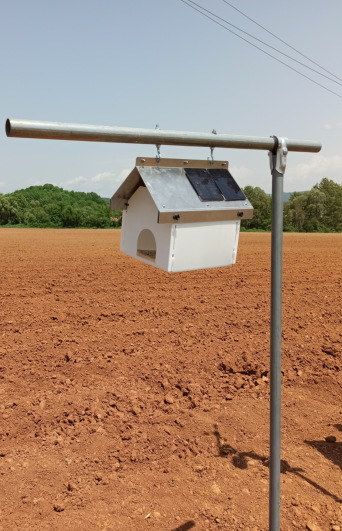
A delta trap with a camera that photographs the sticky card daily and sends the images to the cloud over 5G.

Gateway node

Collects the sensor data and sends it in real time over 4G/5G to the cloud; allows remote configuration of every device.

AgroNIT agro node and gateway installed in a young orchard
AgroNIT weather station beside a field path
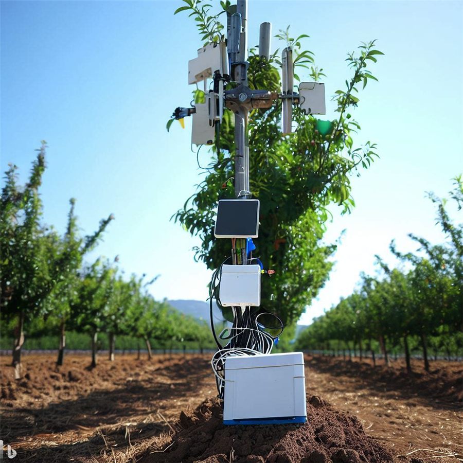
Solar-powered AgroNIT node on bare soil
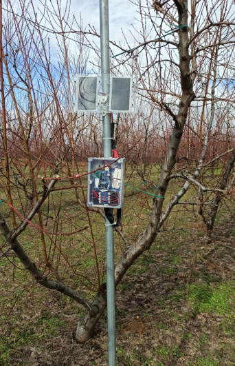
AgroNIT node mounted among fruit trees
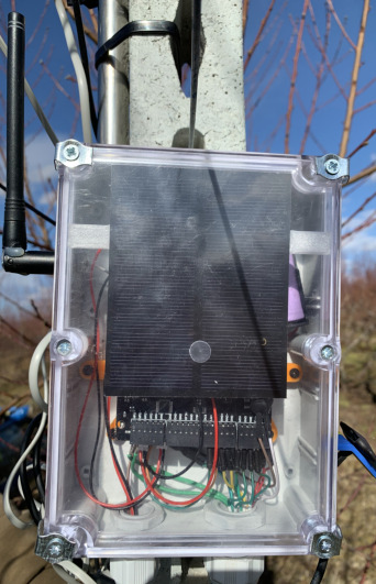
Inside a waterproof AgroNIT node enclosure
Diagram of the AgroNIT data acquisition, data management and application layers

App services

  • Field, crop and farmer information: soil, crop, irrigation system and machinery.
  • Real-time display of all sensor data and images on configurable graphs and heatmaps.
  • AI analytics: real water and nutrient needs, phenological stage (chilling and growing degree hours) and early warning of diseases, pests and adverse weather.
  • Advice and alerts for timely cultivation practices, plus a 48-hour weather forecast with task scheduling.
  • Cultivation calendar and task log for the farmer or supervising agronomist.
  • Crop-health monitoring with drones (RGB / multispectral) and handheld tools such as the DA meter.
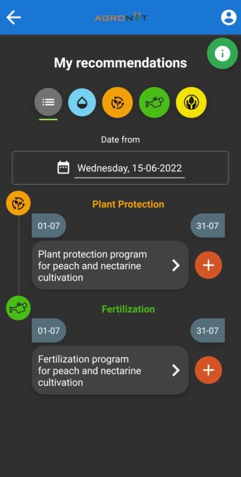
AgroNIT app: recommendations screen
Recommendations
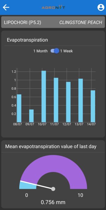
AgroNIT app: evapotranspiration chart
Evapotranspiration
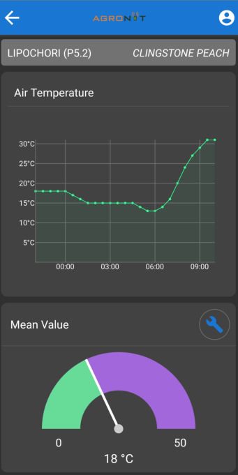
AgroNIT app: air temperature chart
Air temperature
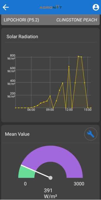
AgroNIT app: solar radiation chart
Solar radiation

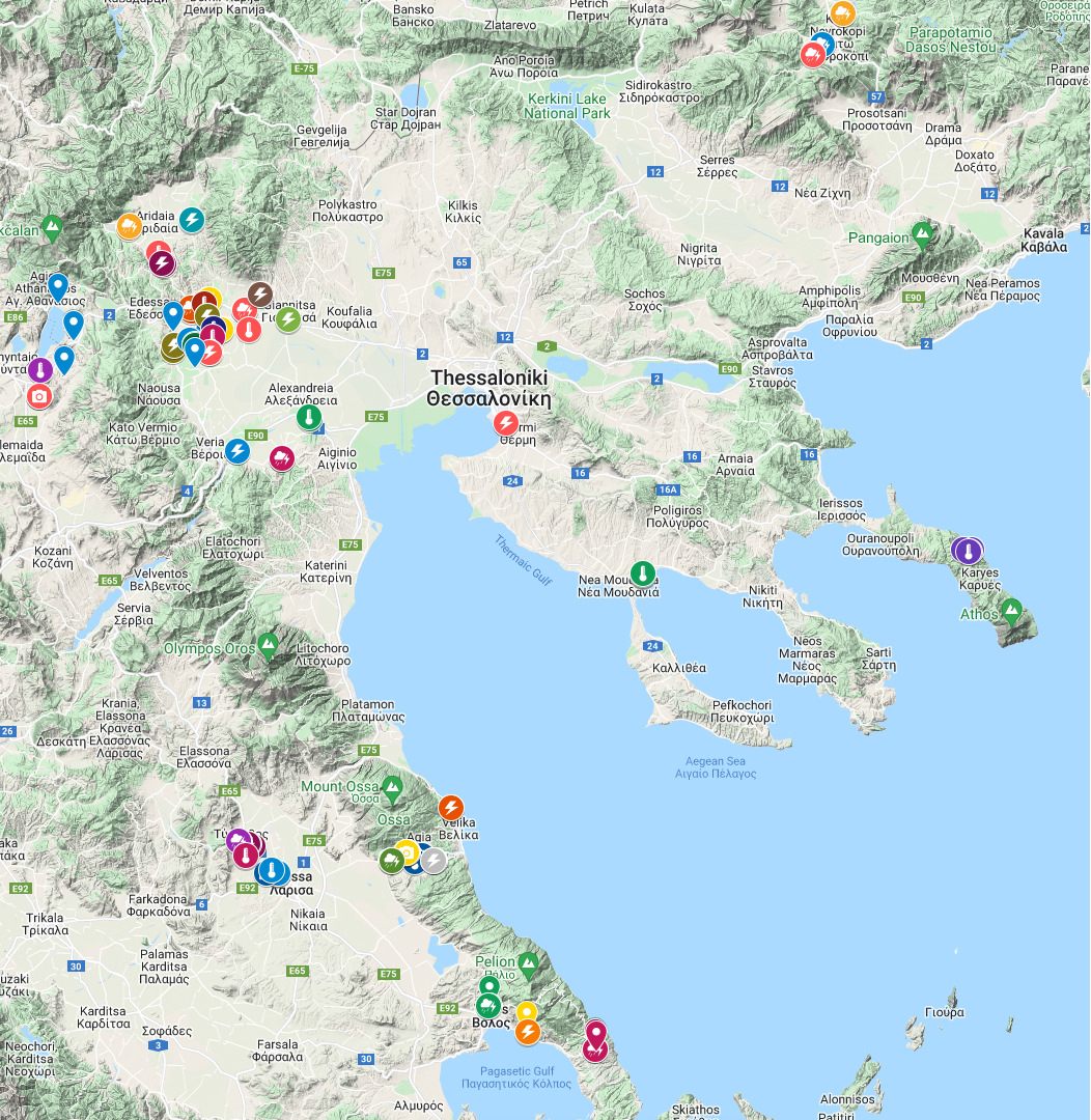
Installations across Northern & Central Greece

AgroNIT nodes and weather stations operate in farms across Northern and Central Greece: Pella, Imathia, Florina, Drama, Thessaloniki, Chalkidiki, Mount Athos, Larisa, Agia and Pelion.

Map of AgroNIT installations in Northern and Central Greece
AgroNIT installations
Downloads

AgroNIT material

Presentations of the AgroNIT ecosystem, with architecture, node specifications and app services (in English).

Featured product

Electronic olive fruit fly trap

AgroNIT delivers an advanced electronic trap for real-time monitoring of olive fruit fly populations, combining IoT, artificial intelligence, cloud and mobile technologies to support sustainable, efficient olive cultivation.

Yellow electronic McPhail-type trap with solar panel installed in an olive tree

Why it matters

  • Early detection of pest activity
  • Reduced pesticide use and production costs
  • Higher yields and better olive quality
  • Environmentally responsible crop protection

Smart monitoring

High-resolution camera recording captures 24/7. AI insect recognition with >90% accuracy, flight-activity prediction up to 48 hours and development-stage forecast for 7–10 days.

Microclimate & location

Integrated temperature and humidity sensors, plus built-in GPS for precise trap geolocation.

Autonomous operation

Solar-powered with low energy consumption. Li-Ion battery autonomy of up to 2 weeks without charging.

Reliable data transmission

A gateway on the mobile network sends images to PANGAEA's own cloud. Full API for integration with public-administration platforms.

Services included

  • Data transfer and AgroNIT app access (mobile & PC) for 4 years
  • Local technical support by specialised staff
  • 2-year warranty & maintenance; equipment lifetime ~5 years
  • Insect recognition with AI models, verified by experts
  • Push notifications and automatic periodic reports
  • Agronomic recommendations based on real pest-population data

Developed in-house by an interdisciplinary team of electrical and computer engineers, agronomists, entomologists and agro-technicians. Low-cost design built from commercially available components, with a 3D-printed camera system based on the classic McPhail trap.

wizCube ecosystem

Smart irrigation

WIZ-CUBE is an intelligent edge-computing IoT platform for selective irrigation and fertigation according to the needs of plants, water and soil.

Remote smart irrigation (open field)

  • Field sensors for UV, light, CO₂, temperature, soil temperature, humidity and water potential.
  • Wireless valve nodes on IEEE 802.15.4, covering from 25×25 m² up to 40×40 km².
  • Edge controller connected to the cloud, with control from a smartphone.
  • Market-leading battery life; valves open in seconds. FCC and CE compliant.
National projects

Precision agriculture in practice

18,000 στρ.Precision farming of olives, Agioi Apostoloi (Vatika, Laconia)
4,000 στρ.Precision farming of olives, Palaiopanagia (Sparta, Laconia)

Under the Operational Work Programmes of Olive Producer Organisations (ΟΕΦ) 2024/2027, PANGAEA R&D® brings precision agriculture to two olive cooperatives in Laconia, in the Peloponnese.

Π2-47.OL.1β Εφαρμογή γεωργίας ακριβείας στην καλλιέργεια της ελιάς (18.000 στρ.)

Αγροτικός Ελαιουργικός Συνεταιρισμός Αγίων Αποστόλων – Οργάνωση Παραγωγών · Ο.Ε.Φ. 2024/2027 (Καν. (ΕΕ) 2021/2115, Στρατηγικό Σχέδιο ΚΑΠ 2023/2027)

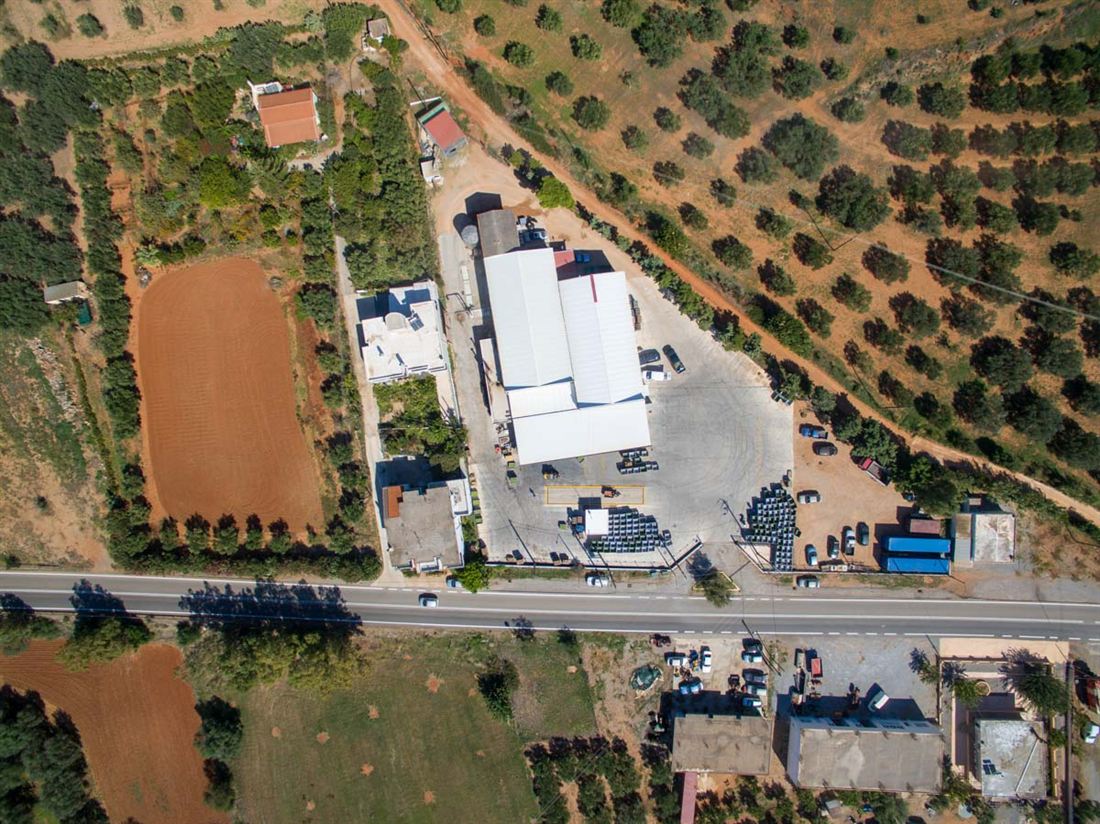
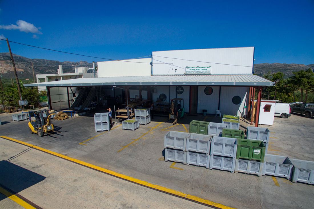
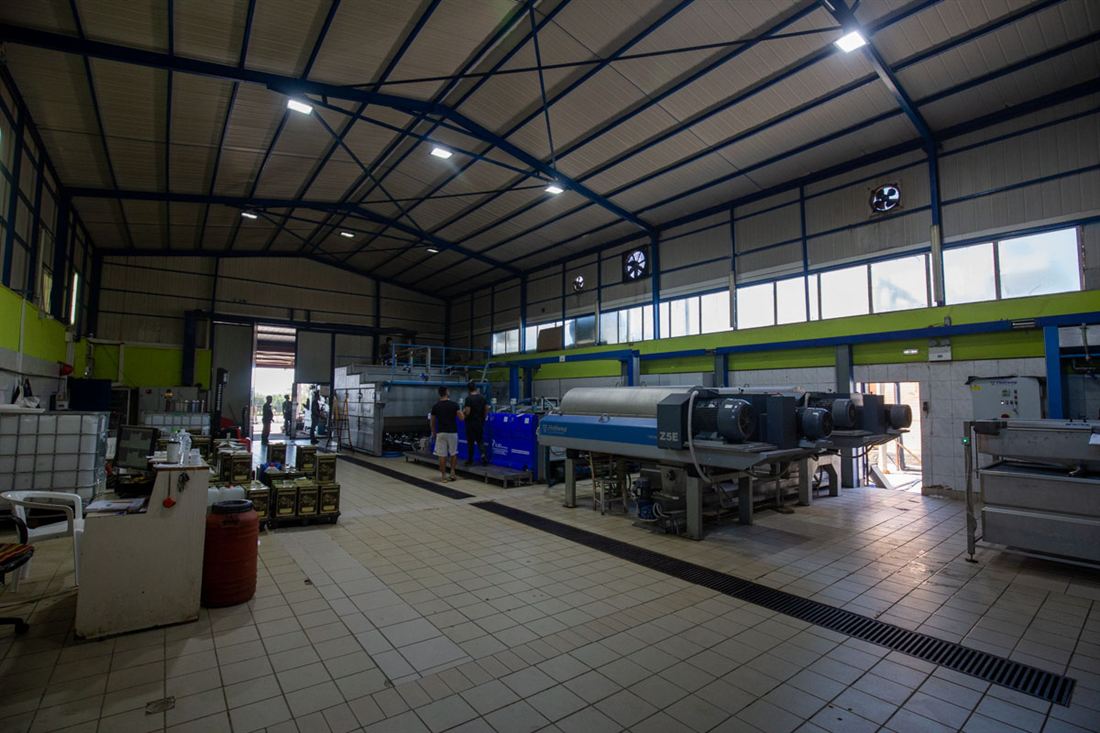
The Agricultural Olive Cooperative of Agioi Apostoloi was founded in 1982 in Vatika, at the south-eastern tip of mainland Europe, opposite Kythira and near Monemvasia. Its olive mill serves more than 500 producers and produces up to 2,000 tonnes of extra virgin olive oil a year from the local Athenolia variety. Harvest starts in early October, earlier than in most of Greece.

Aerial view of the Agioi Apostoloi olive mill among olive groves
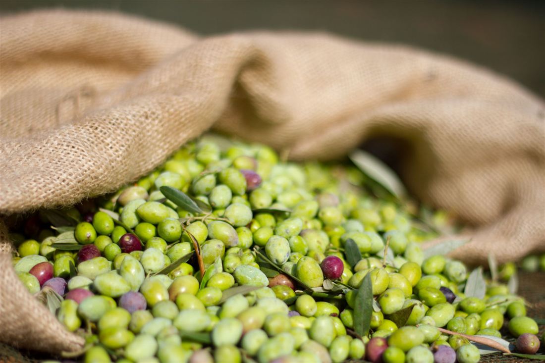
Freshly harvested olives in a sack
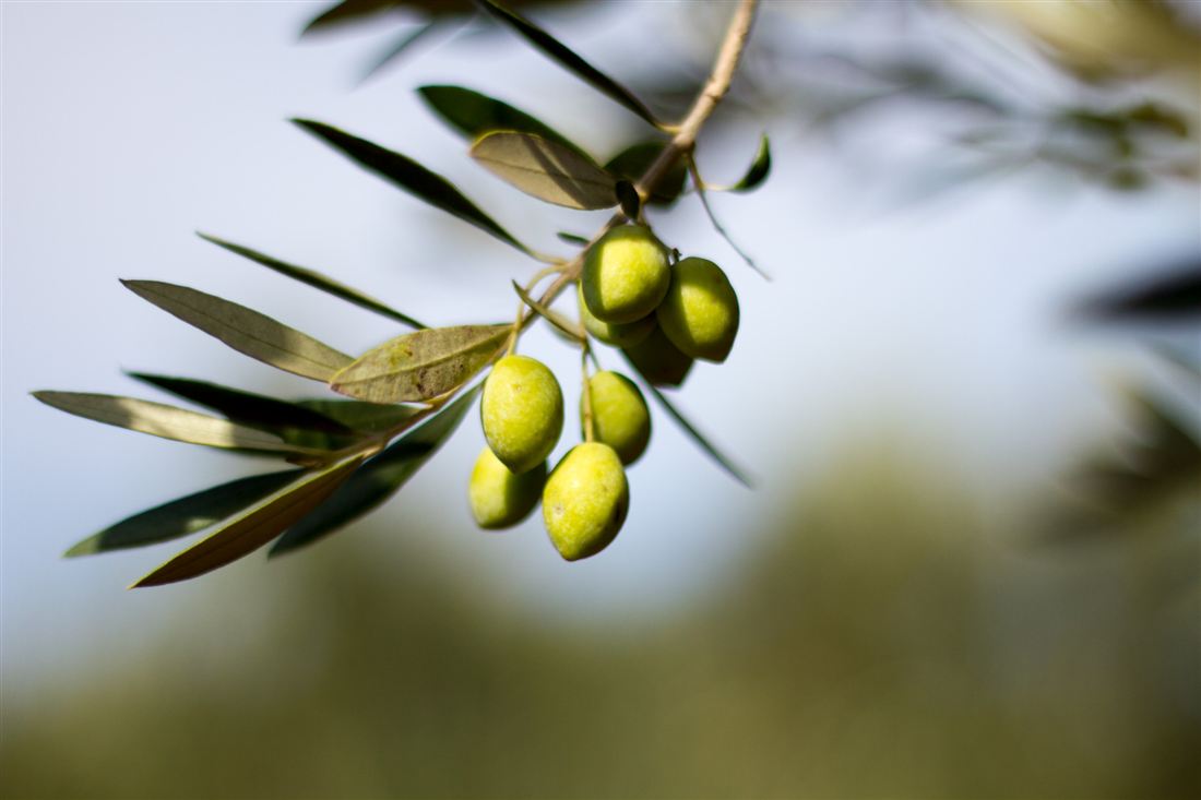
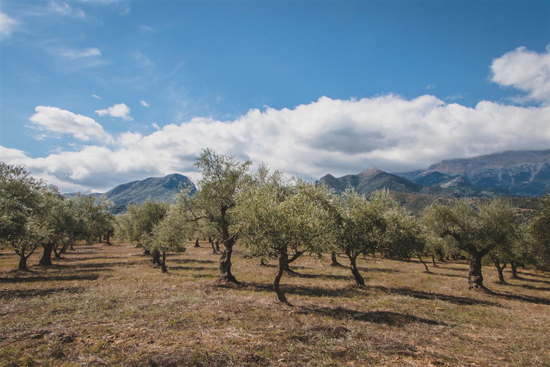
Olive branch with green olives
Olive reception yard of the Agioi Apostoloi mill
Automated extraction line inside the Agioi Apostoloi olive mill
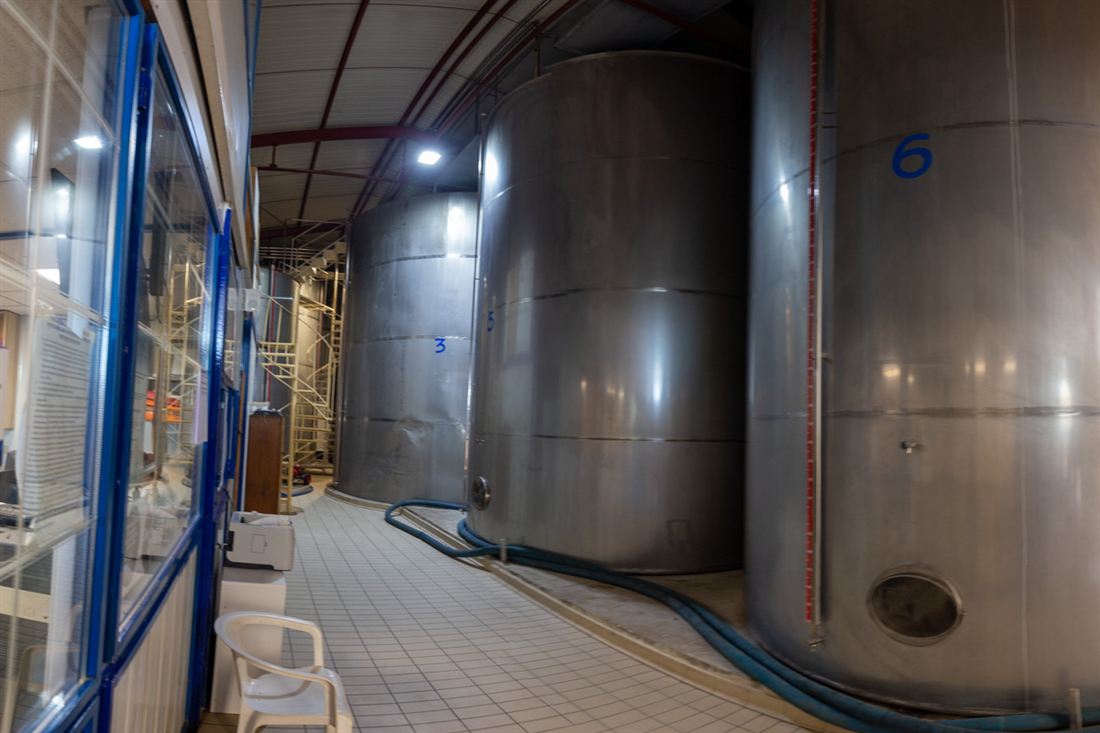
Stainless steel olive oil storage tanks
Area
Agioi Apostoloi, Vatika, Laconia
Precision-farmed area
18,000 στρ. (1,800 ha) of olive groves
Olive mill
Since 1982 · >1 t of oil per hour · malaxation below 30 °C
Certifications
AGRO · ISO 22000:2018 · ISO 22005:2007
Δραστηριότητες προγράμματος
  • Π2-47.OL.1α – Επενδύσεις σε υλικά και άυλα περιουσιακά στοιχεία: εξοικονόμηση ενέργειας και ανανεώσιμη ενέργεια· μείωση εκπομπών και αποβλήτων· ανθεκτικότητα έναντι επιβλαβών οργανισμών και ολοκληρωμένη φυτοπροστασία· βελτίωση ποιότητας προϊόντων.
  • Π2-47.OL.1ε – Βιωσιμότητα και αποτελεσματικότητα μεταφοράς και αποθήκευσης προϊόντων.
  • Π2-47.OL.1β – Συμβουλευτικές υπηρεσίες και τεχνική βοήθεια.
  • Π2-47.OL.1ε – Προώθηση, επικοινωνία και εμπορία.
  • Π2-47.OL.1ζ – Συστήματα ποιότητας.
  • Π2-47.OL.1η – Συστήματα ιχνηλασιμότητας και πιστοποίησης.

Π2-47.OL.1β Εφαρμογή γεωργίας ακριβείας στην καλλιέργεια της ελιάς (4.000 στρ.)

Αγροτικός Συνεταιρισμός Ελαιοπαραγωγών Παλαιοπαναγιάς – Οργάνωση Παραγωγών · Ο.Ε.Φ. 2024/2027, απόφαση ΥπΑΑΤ αριθ. 2756/309999/14.10.2024

The Agricultural Cooperative of Olive Producers of Palaiopanagia was founded in 1965 in a village of about 400 people at the foot of Mount Taygetos, in the Municipality of Sparta. Olives cover more than 90% of the farmland. The cooperative runs a modern olive mill that meets the latest environmental standards, bottles and sells its olive oil, and supplies its members with fertilisers and other farm inputs. Its extra virgin olive oil won 2nd prize for its high phenol content.

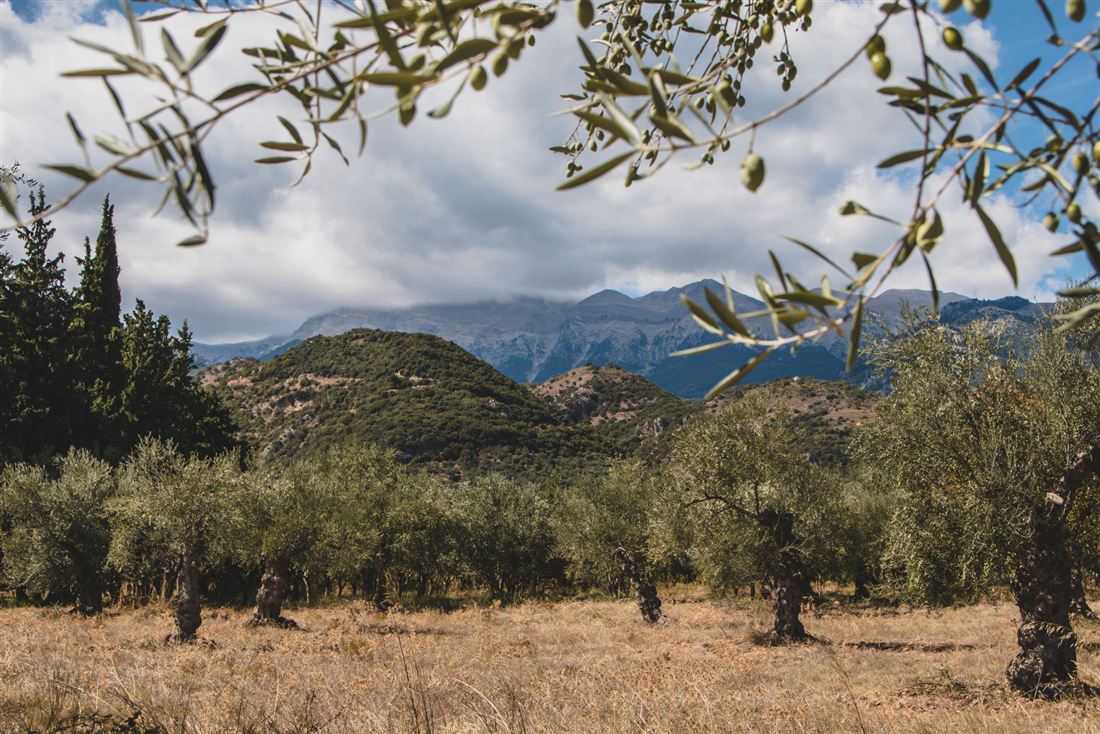
Olive grove at Palaiopanagia with Mount Taygetos behind
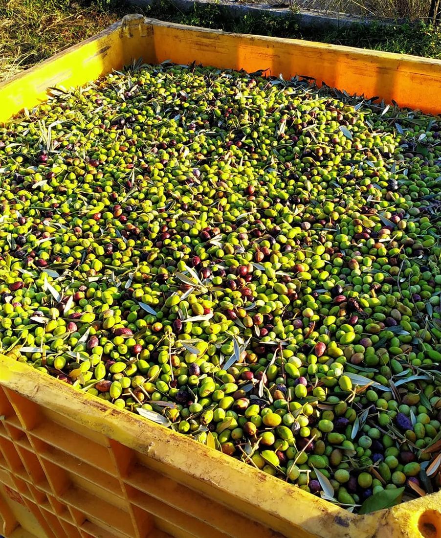
Crate of freshly harvested olives
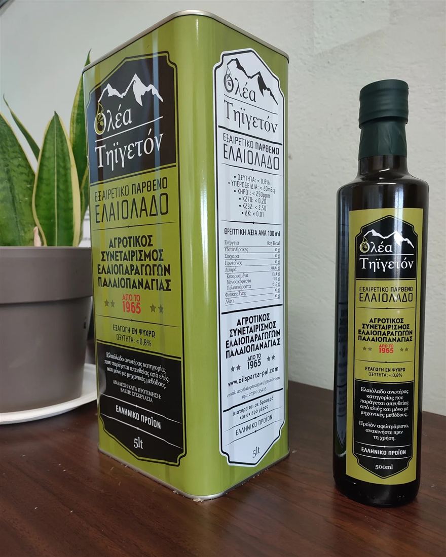
Palaiopanagia cooperative olive oil in tin and bottle
Traditional olive grove near Palaiopanagia
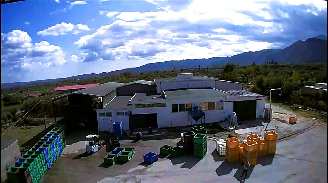
Palaiopanagia olive mill with Taygetos in the background
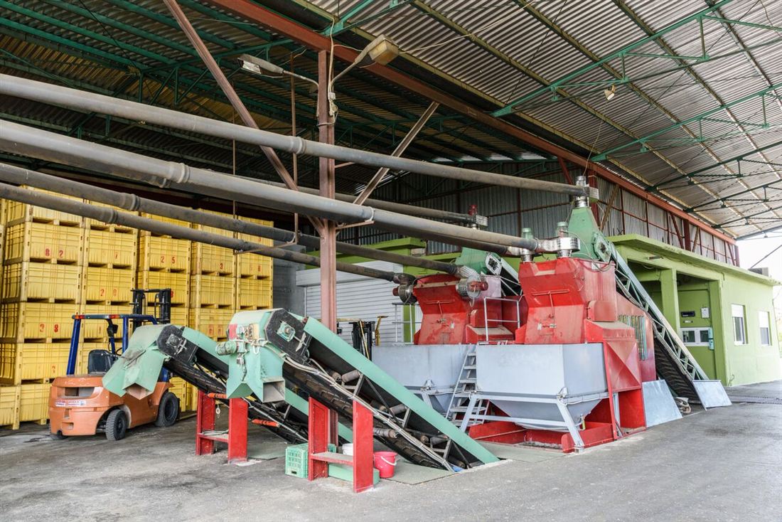
Olive reception and cleaning line at the Palaiopanagia mill
Area
Palaiopanagia, Sparta, Laconia
Precision-farmed area
4,000 στρ. (400 ha) of olive groves
Founded
1965
ΟΕΦ training 2025
Precision agriculture in olive growing, new techniques, AGRO, ISO 22000 & ISO 22005, via farmacademy.gr
Δραστηριότητες προγράμματος
  • Π2-47.OL.1α – Επενδύσεις σε υλικά και άυλα περιουσιακά στοιχεία: εξοικονόμηση ενέργειας και ανανεώσιμη ενέργεια· μείωση εκπομπών και αποβλήτων· ανθεκτικότητα έναντι επιβλαβών οργανισμών και ολοκληρωμένη φυτοπροστασία· βελτίωση ποιότητας προϊόντων.
  • Π2-47.OL.1ε – Βιωσιμότητα και αποτελεσματικότητα μεταφοράς και αποθήκευσης προϊόντων.
  • Π2-47.OL.1β – Συμβουλευτικές υπηρεσίες και τεχνική βοήθεια.
  • Π2-47.OL.1γ – Κατάρτιση, καθοδήγηση και ανταλλαγή βέλτιστων πρακτικών.
  • Π2-47.OL.1ε – Προώθηση, επικοινωνία και εμπορία.
  • Π2-47.OL.1ζ – Συστήματα ποιότητας.
  • Π2-47.OL.1η – Συστήματα ιχνηλασιμότητας και πιστοποίησης.

Photos: agioiapostoloicoop.gr, oilsparta-pal.com and greekonline.gr.

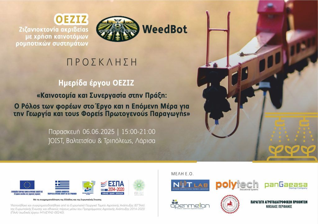
WeedBot / OEZIZ project poster

Μ16ΣΥΝ200240 – ΟΕΖΙΖ

Ζιζανιοκτονία ακριβείας με χρήση καινοτόμων ρομποτικών συστημάτων

Precision weed control using innovative robotic systems.

The OEZIZ project, also known as WeedBot, is taking agricultural robotics into the field, developing innovative robotic systems for precision weeding from its base in Larisa.

Operational group
NITLab (University of Thessaly), POLYTECH, PANGAEA, Open Mellon, Nikolaos Perifanos (agri-food producer)
Funding
EAFRD and national resources, RDP 2014–2020
  1. Project workshop “Innovation and Collaboration in Practice: The Role of Stakeholders in the Project and the Next Day for Agriculture and Primary Production Stakeholders” at JOIST, Valtetsiou & Tripoleos Strs, Larisa, presenting the project's results and the potential of agricultural robotics.
weedbot.gr ↗
Climate resilience · Measure 16 “Cooperation”

xWeather: 3-day frost & heatwave forecasting at microclimate level

Climate change brings more frequent extreme weather, which hits crop yields and the local economy through the compensation paid for damage. The two xWeather operational groups extend the network of weather stations into high-risk farming areas and connect it to certified forecasting services, so that frost and heatwave forecasts reach field-level accuracy.

The result: farmers receive daily digital weather bulletins and advisory alerts tailored to the local climate and crop, for timely prevention and treatment. In Thessaly the alerts also cover the risk of diseases and insect pests.

2 × 11New weather stations, in Pella and Larisa
3 daysFrost & heatwave forecast horizon
24 monthsProject duration, 2023–2025

Work packages

  1. Preparation: analysis of the current situation, study of each area's crops, design of the experimental set-up and wireless data network.
  2. Installing the weather stations at the selected sites and building the wireless network that collects data from the fields.
  3. Linking the data with numerical weather prediction models, issuing digital advisory alerts and developing high-resolution microclimate models.
  4. Dissemination: project workshop and publication of the results in scientific and popular media.
xWeather Makedonia logo

Μ16ΣΥΝ2-00372 – ΟΕΡΟΜΑΚ · xWeather Makedonia

Πρόγνωση Παγετού και Καύσωνα 3 ημερών σε επίπεδο μικροκλίματος για τους παραγωγούς της Κ. Μακεδονίας

Pella was chosen because it receives the highest annual compensation from ELGA (the Hellenic Agricultural Insurance Organisation) for damage caused by adverse weather. Eleven weather stations are being installed around Kalyvia Skydras, on fields of members of the local agricultural cooperative.

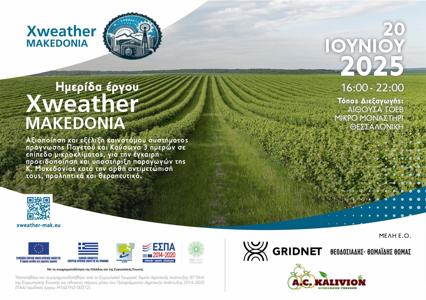
Invitation to the xWeather Makedonia project workshop, 20 June 2025
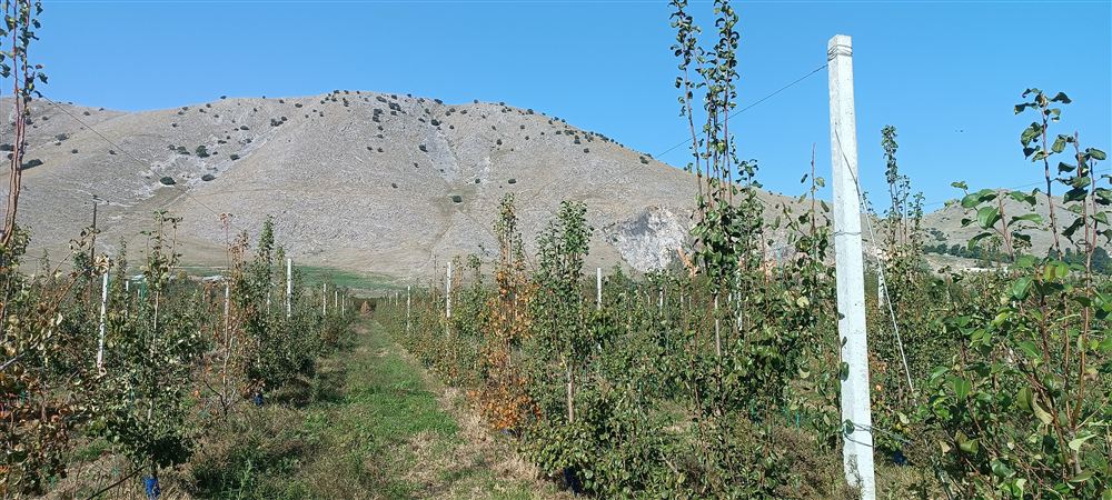
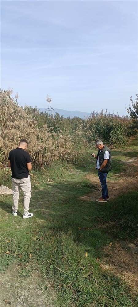
Choosing weather-station sites in an orchard near Kalyvia
Fruit orchard in the Kalyvia area, Pella
Area
Kalyvia Skydras, Pella
Operational group
GRIDNET S.A. (coordinator), Th. Theodosiadis-Thomaidis, A.C. Kalyvion
Duration
April 2023 – June 2025
  1. Kick-off meeting at the Kalyvia agricultural cooperative: plan for 11 weather stations.
  2. Field visit with GRIDNET technicians, the cooperative's president and 3D General Aviation Applications to agree the station sites.
  3. Project workshop at the ΤΟΕΒ hall, Mikro Monastiri, Thessaloniki.
xWeather in Thessaly logo
Μ16ΣΥΝ2-00373 – ΟΕΡΟΘΕΣ · xWeather in Thessaly
Πρόγνωση Παγετού και Καύσωνα 3 ημερών σε επίπεδο μικροκλίματος για τους παραγωγούς της Θεσσαλίας

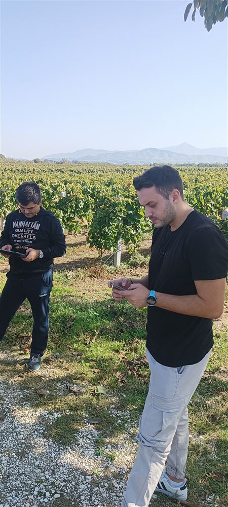
Larisa is the prefecture with the third-highest annual ELGA compensation for weather damage. Eleven weather stations are being installed around Tyrnavos, on fields of members of ΑΣΕΠΟΠ Tyrnavos, and the forecasts also warn of diseases and insect pests.

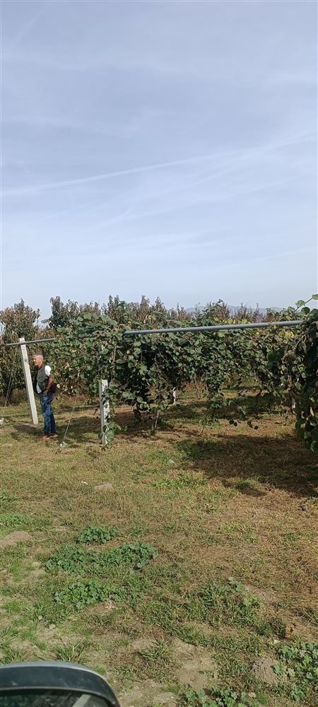
Orchard near Tyrnavos where a weather station is planned
Project team during the field visit near Tyrnavos
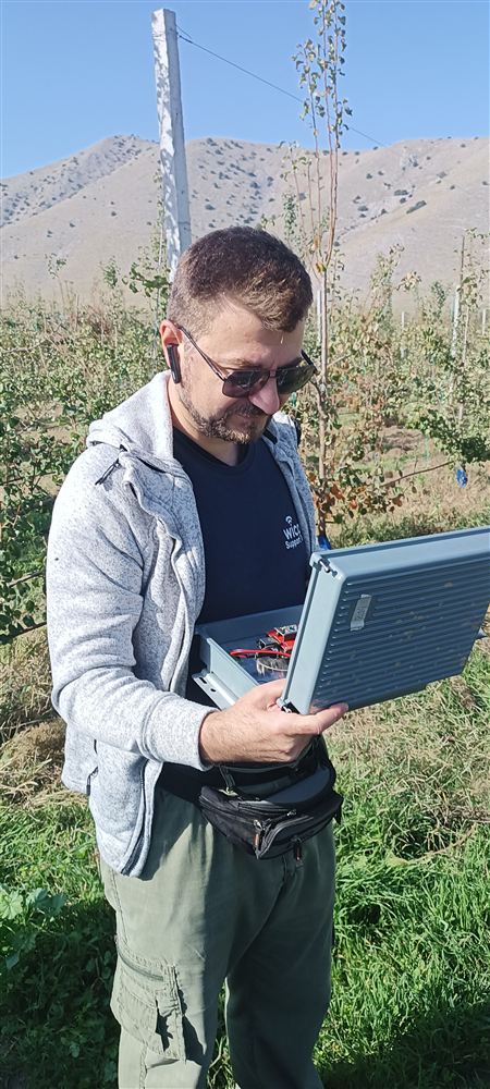
Technician recording a station location on a laptop in the field
Area
Tyrnavos, Larisa
Operational group
GRIDNET S.A. (coordinator), Th. Theodosiadis-Thomaidis, ΑΣΕΠΟΠ Tyrnavos
Duration
May 2023 – June 2025
  1. Kick-off meeting at ΑΣΕΠΟΠ Tyrnavos, Larisa: plan for 11 weather stations.
  2. Field visit with GRIDNET technicians, the cooperative's agronomist and 3D General Aviation Applications to agree the station sites.
  3. Project workshop at JOIST, Future Learning Lab, Larisa.

Co-financed by Greece and the European Union through the European Agricultural Fund for Rural Development (EAFRD), Rural Development Programme 2014–2020, Measure 16 “Cooperation” · European Innovation Partnership for Agriculture (EIP-AGRI). Photos: xweather-mak.eu and xweather-thes.eu.